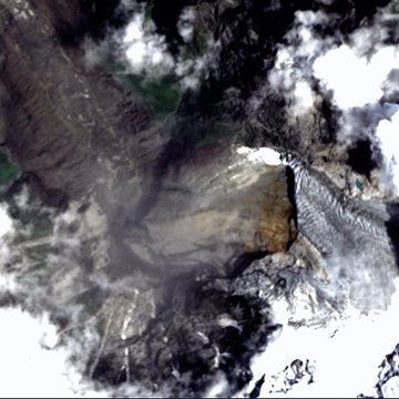
By TRH News Desk
Geographer Dr Vaibhav Kaul on the Nepal floods highlighted the need to examine the impact of climate warming not only on glaciers but also on the stability of the bedrock underneath and around them.
New Delhi, September 2, 2026 — Geographer Vaibhav Kaul says the thermal destabilisation of peri-glacial environments is as concerning as the destabilisation of glaciers themselves. According to his assessment, the Langtang Himal region experienced an abnormally warm winter this year, as it did during the previous three years, followed by large spring snowstorms.
This combination, he says, could have contributed to exceptionally high meltwater seepage into the bedrock, alongside rapid permafrost thawing and freeze-thaw shattering within the rock.
With climate warming accelerating, including during winter, Kaul argues that intensified melting and fracturing of glaciers such as those on Langtang Lirung appears to be reducing the stability of high-mountain rockslopes through several interconnected processes.
The first mechanism identified by Kaul is the increased volume of meltwater entering the bedrock.
According to him, greater quantities of meltwater can seep into existing cracks, weakening the rock by progressively widening those cracks through repeated cycles of freezing and thawing.
This process can become particularly significant in high-altitude environments where water repeatedly freezes and melts within fractured rock.
Permafrost thaw exposing more bedrock
Kaul also points to the increasing exposure of bedrock as glaciers melt.
Greater surface areas of bedrock are exposed to direct atmospheric heating as well as warm summer rainfall, including extreme-intensity rainfall events.
This, he says, accelerates the melting of permafrost within the bedrock and allows additional water to enter through existing cracks.
The repeated freeze-thaw process can then progressively widen those cracks, making the rock increasingly susceptible to failure.
Kaul said he could confidently conclude that the melting and fracturing of glaciers due to climate warming, including rising winter temperatures over recent years, would have contributed to greater meltwater seepage into the bedrock and the weakening of the rock.
He also pointed to the role of warmer conditions and rainfall in accelerating permafrost loss and increasing the amount of water entering cracks in the rock.
Loss of glacial support
A third mechanism involves steep or overhanging sections of bedrock that are held in place by glacial ice.
Kaul says that in some locations, the ice effectively keeps such sections of rock in place. As that supporting ice melts, those steep or overhanging sections can become significantly less stable.
He says this process also contributed to the Langtang Lirung ice-and-rock avalanche.
The implication of Kaul’s assessment is that glacier loss can have consequences beyond the reduction in ice itself. The disappearance of supporting ice can alter the stability of adjacent rock and contribute to high-mountain slope failures.
A Wall of Water, a Wall of Silence: Inside China’s Handling of the Tibet Flood Disaster
Revised estimate of initial avalanche volume
Kaul has also provided a substantially revised calculation for the volume of the initial avalanche.
His previous estimate was based on an area of approximately 0.23 square kilometres, equivalent to about 57 acres, representing the collapsed glacial ice and dead ice.
Using an estimated average thickness of about 22 metres, the calculation produced an initial volume of approximately 5 million cubic metres, or 5 billion litres.
Kaul’s revised estimate is considerably larger.
The first component of the revised calculation covers approximately 0.3 square kilometres, or about 74 acres, representing the area of collapsed ice and dead ice.
With a combined average thickness of approximately 115 metres, including the underlying bedrock, this produces an estimated volume of 34.5 million cubic metres, equivalent to 34.5 billion litres.
A second component adds approximately 0.18 square kilometres, or about 42 acres, of additional failed rock and overlying debris, ice and snow.
Using an average thickness of approximately 90 metres, Kaul estimates this component at another 16.2 million cubic metres, or 16.2 billion litres.
Together, the two components amount to approximately 50.7 million cubic metres, or 50.7 billion litres, before adding meltwater from above.
Avalanche estimate rises more than tenfold
The revised calculation therefore represents a major increase from Kaul’s earlier estimate of approximately 5 billion litres for the initial avalanche.
The new calculation comprises: 34.5 billion litres from the collapsed ice, dead ice and underlying bedrock; 16.2 billion litres from additional failed rock and overlying debris, ice and snow; Plus meltwater from above.
This puts the calculated initial volume at more than 50 billion litres, even before the additional meltwater is included.
Kaul’s latest assessment consequently places greater emphasis on the interconnected relationship between glacier melting, permafrost thawing, meltwater penetration, freeze-thaw fracturing and the stability of surrounding mountain rock.
The Langtang Lirung avalanche, in this assessment, cannot be viewed only through the volume of ice that collapsed. The revised calculation incorporates substantial volumes of underlying and adjacent bedrock as well as overlying debris, ice and snow.
The new figures also reinforce Kaul’s earlier assessment that the avalanche became much larger as it moved down the mountain, incorporating additional material during its descent.
The latest inputs therefore present the Nepal flood disaster as a complex interaction between glacial ice, bedrock, permafrost, meltwater and climate-driven changes in the high-mountain environment.
Nepal Floods Were Bigger Than First Thought: Avalanche Estimate Revised to 150 Billion Litres
Follow The Raisina Hills on WhatsApp, Instagram, YouTube, Facebook, and LinkedIn